Early in the year of 2023, drastic improvements were made to the city's network of bike lanes. A four-kilometre stretch of Garden Grove Boulevard, Trask Avenue, and Edwards Street altogether were "road-dieted" to make space for new bike lanes and dedicated right turn lanes. Garden Grove Boulevard had the greatest improvements, as it had gotten a complete two-way bike track that is completely protected with concrete kerbs and trees. Trask and Edwards had only gotten veneer strips of paint, but an improvement is an improvement nonetheless!
The Orange County Transportation Authority categorises the improvements on Garden Grove Boulevard as Class I, which can be defined as "a completely separated right-of-way designated for the exclusive use of bicycles and pedestrians". As such, the improvements on Trask and Edwards are categorised as Class II, where a painted bike lane "provides a restricted right-of-way designated for the exclusive or semi-exclusive use of bicycles with through travel by motor vehicles or pedestrians prohibited, but with vehicle parking and crossflows by pedestrians and motorists permitted". (source, section 1.3)
|
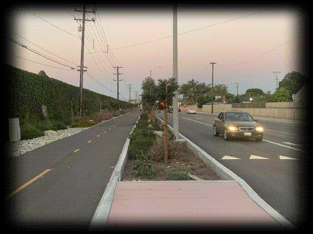
Class I bikeway on Garden Grove Boulevard, separated by concrete kerbs and trees.
|
Although these improvements are very recent, the idea of getting new bikeways has been lingering within Westminster's politics for more than a decade. A report from 2009 by the Orange County Transportation Authority shows that constructing Class III, II, and I bikeways has been one of Westminster's desires for many years. Unfortunately, most of these projects never saw a future despite survey results proving that residents truly do desire alternative transportation methods. More than fifty per cent of the respondents cited that the devastating lack of bicycle infrastructure was the main obstacle to riding their bicycles in Orange County. (source, pages 192 and 205-212)
Westminster's public city website has announced several bikeway and roadway improvement projects, like the Mendez Historic Trail and Green Street Bikeway. This project was to transform Hoover Street from a four-lane collector road to a two-lane street with Class I bikeways. Construction was supposed to commence in 2020, but a Google Maps journey through time will show you that nothing has changed besides the trees on the sidewalk, which have grown ever so slightly. (source)
The Mendez Historic Freedom Trail and Monument project is another to be listed on the website. A monument park celebrating the civil rights achievements of the Mendez family was constructed starting near the end of the year of 2019. Progress, at first, was stagnant. The long-time vacant plot was cleaned up and fenced. Dark-sky approved lamp posts were installed first, then came the trees and decorations that represented the service that the Mendez family had done for civil rights, and the project was completed before 2023.
The Rancho Road Landscaping and Lighting Improvements project is one of the listed bikeway projects. The goal of this project was to add boulders, drought-tolerant plants and trees, and irrigation and streetlight systems along the existing Class I bikeway on Rancho Road in the year of 2019. Another Google Maps journey through time will show that the city actually put the effort to implement these changes, and the project was completed in 2021.
Let's circle back to the newly-constructed bikeways in Westminster's first district. The first thing that you would notice about these bikeways is the lack of usage. It's mostly void of any cyclists or pedestrians, and the most activity that happens is on the street where cars can speed by. This speed problem—especially on Garden Grove Boulevard—is blatantly thanks to the simplistic design of the roads, no doubt. Traffic calming devices, such as speed tables (not bumps or humps, I will explain why), chicanes or bends, and raised intersections and crosswalks were obviously not considered during the design of the improvements. Garden Grove Boulevard, which has a terrible history of street racing and car accidents, is where most of the concern's at. In order to actually access the bike path, road users will have to cross the street. Luckily, crosswalks with reflective yellow signs and flashing beacons were installed. But, drive down this street, which has a posted speed limit of 45 miles per hour (75 kilometres per hour), and you'll notice it is very easy to go way over the posted speed limit because it's not a very difficult road to drive on. Not only is the posted speed limit outrageous for such a road design, but it makes stopping for any obstacle on the road much more difficult. Therefore, a driver is likely not to slow down for a pedestrian waiting to cross the street, even when they see said pedestrian and flashing beacons, because it would require them to completely stop from at least 75 kph. Furthermore, a driver who wishes to make a right turn into one of the properties or smaller side-streets will need to slow down to at least under 10 mph (16 kph) in order to safely make their desired turn. Combine this with the high through-travel speed of 75 kph and you won't be shocked to encounter a rear-end collision.
|
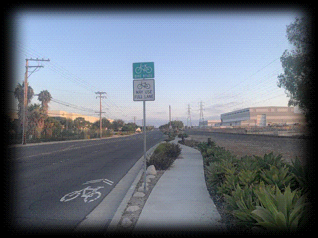
Class III bikeway on Hoover Street.
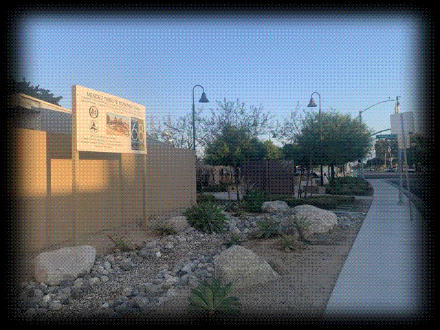
Mendez Tribute Monument Park, at Olive Street and Westminster Boulevard.
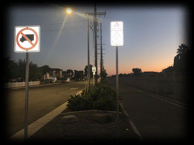
Rancho Road Bikeway Landscaping Improvements
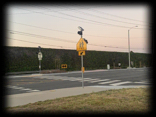
Crosswalk on Garden Grove Boulevard at Seneca Drive
|
Thankfully, there is a perfect traffic calming device for such instances, and it's called a speed table! Firstly though, the differences between speed bumps, speed humps, and speed tables need to be made clear. A speed bump is a bump in the road, duh... Cars are meant to do no more than 15 kph over these bumps or they could potentially sustain damage. The optimal environment for a speed bump is in the car park of a shopping centre. A speed hump could be described as a longer speed bump. It's less rough and steep, so a car can go over it doing 20 mph (30 kph). You can find speed humps mostly in public residential neighbourhoods. Lastly, a speed table is an even longer speed bump, and cars can do up to 75 kph over it (50 kph recommended).
When comparing these potential applications for Garden Grove Boulevard's traffic calming measures, it's not hard to understand why speed bumps are the least appropriate option. This leaves two options: the speed hump, and the speed table. The speed hump still seems like a very extreme calming measure, especially if drivers are naturally and instinctively going over the posted speed limit. Therefore, a speed table might be the best option to calm drivers. This brings us to the concept of a raised crosswalk and a raised intersection. Remember that there are three designated crosswalks that come with these improvements. The National Association of City Transportation Officials describes the combination of a speed table and a crosswalk as a raised crosswalk. The same concept applies to a raised intersection. Therefore, shouldn't the three crosswalks instead be raised crosswalks, as opposed to their current states of simply being paint veneers? Speed reduction and a safe crosswalk, all-in-one. (source 1, source 2)
|
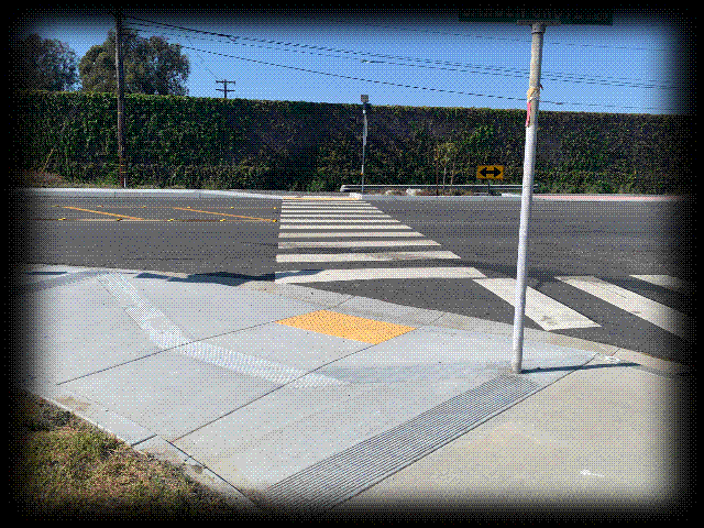
Flat crosswalk at Seneca Drive
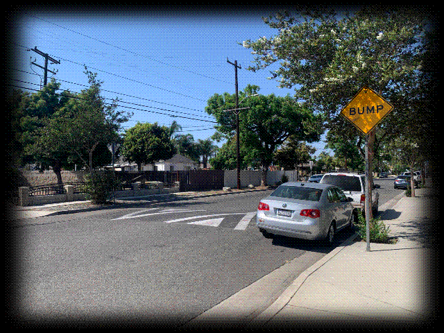
Speed hump on King Street in Santa Ana
|
What about the centre lane? Well, it exists because there are a lot of properties on Garden Grove Boulevard whose only outside connection is Garden Grove Boulevard itself. However, the centre lane seems to be a signal that codes, "We planners are simply too lazy to actually draw any dedicated turn lanes." And also, where does one going eastbound on Garden Grove Boulevard beyond the Garden Grove Freeway (CA-22) on/off-ramp need to use the centre lane to turn left?
Captain Obvious says dedicated turn lanes are lanes dedicated only for turning drivers. The US DOT FHWA says dedicated turn lanes can drastically reduce crashes, especially rear-end crashes. How? They take away the need for through-traffic to slow down for turning traffic, which as explained before, needs to slow down to safely make their turns. That's why turning onto Westminster Boulevard from Beach Boulevard requires the utilisation of a turn lane, unless you desire to be rear-ended at highway speeds. (source)
|
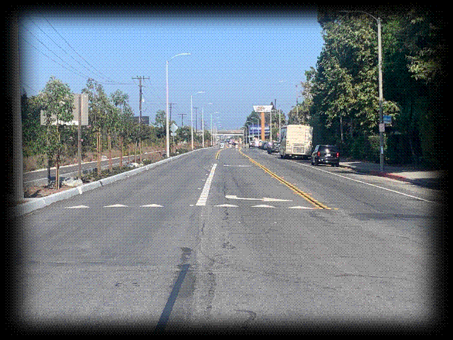
Dedicated turn lane and centre lane on Garden Grove Boulevard
|
In this displayed graphic, conflict points (driveways, intersections, etc.) are plotted according to the legend. You could see that the amount of conflict points in the less than two-kilometre stretch of Garden Grove Boulevard is astonishingly absurd. That would be a lot of potential rear-end and T-bone collisions. There are 21 total conflict points within that stretch, which means an average of one conflict point for every 47,6 metres. The actual definition of conflict point does not correspond with the way I use the term here (I can't be bothered to count, there are probably more than hundreds of conflict points), but my point still stands. Because of this, access management is not something that the planners in charge of this project should have overlooked. Not only do the high number of conflict points and lack of access management on Garden Grove Boulevard create a lot of danger for drivers, but pedestrians and cyclists are also highly endangered using the sidewalk. If you want to understand more, read the brochure about access management from the US DOT FHWA. (source)
|
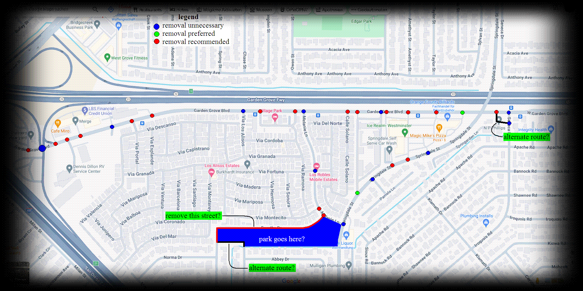
Map of intersections and conflict points on Garden Grove Boulevard
|
Kerb extensions should also have been considered during the design process. Kerb extensions...are extensions of the kerb. This is done for a variety of results. First and foremost, the distance a pedestrian needs to cross the road is effectively reduced. Pedestrian visibility would be drastically increased (extensions prevent trees and cars from hiding pedestrians). Cars drive slower through these extensions because the road narrows. Cars turn more slowly because the corners are sharper. Even with the turn lanes, it is still possible to create kerb extensions because there are parking spots that can be removed and the existing lanes are so wide that they can simply be narrowed to make space for the extensions. (source)
Frankly, the intersection of Garden Grove and Edwards should be a roundabout, as opposed to simply being a traffic-signal-controlled three-way intersection. It would be Westminster's first roundabout, and it would also make the city more beautiful. Just a little, irrelevant tidbit.
|
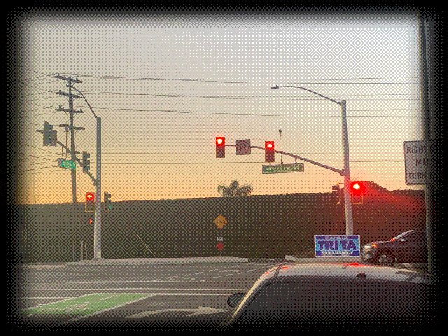
New traffic signal pattern at Garden Grove Boulevard and Edwards Street
|
Let's circle, again, now to the new bike lanes on Trask and Edwards. These bike lanes are just like any old bike lane in Westminster. The distinctive green paint is a new feature that makes these new bike lanes stand out when compared to any other old bike lane in Westminster. The problem here is that these bike lanes don't provide any real or physical protection for the cyclists that use them, if any. When driving down this road, it is not uncommon to see people drive over the painted bike lanes. And people for some reason also prefer leaning close to the edge of the bike lanes, as opposed to driving in the middle of their own lane. The bright green paint only serves its purpose to remind drivers to stay in their lane, but it can do no more to keep cyclists from being harmed.
You may or may not be wondering why these new bike lanes have green paint, whilst the older bike lanes in Westminster don't. The answer is fairly simple: green paint was approved for bike lanes in April of 2011. This means all the bike lanes that don't have green paint have existed for much longer...and residents don't use these bike lanes for a reason. They're not visible enough, and they have no protection. Just a veneer of paint. It doesn't feel welcoming to ride a bike on a road where drivers can barrel down right beside you at speeds greater than 60 kph (35 mph). (source)
What should have been protection for the bike lanes on Trask and Edward are the parked cars that sit between the bike lanes and the sidewalk. Why did the bike lanes need to be sandwiched between the travel lane and the parked cars? Although the true solution would be to make the bike lanes sidewalk-level, parked cars should have been the barrier for the bike lanes if you're going to do the bare minimum as a planner. Some people may point out that visibility could be a big problem if this amendment was implemented. This concern is valid for the application on Trask Avenue because homeowners' driveways on Trask are directly connected to the main road. However, houses on Edwards have their driveways connected either to a side street or an alley. This application would have been absolutely perfect on Edwards Street.
|
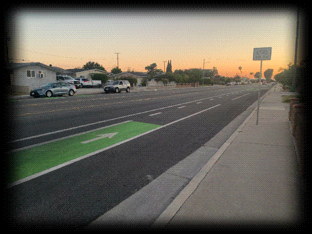
Start of Class II bikeway on Trask Avenue
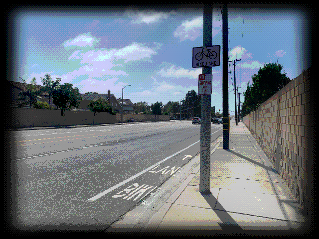
Start of Class II bikeway on Edinger Avenue at Ord Way
|
Whilst crosswalks were installed on Garden Grove Boulevard, no intersections had crosswalks installed on Trask and Edwards. The only reason why Garden Grove Boulevard has any crosswalks to begin with is because the bike path would have been practically inaccessible without them. On Trask and Edwards, however, there are several intersections that are perfectly suitable for a crosswalk installation. Bannock Road, Kiowa Road, and Bestel Avenue on Edwards Street are all capable of being retrofitted with crosswalks. On Trask Avenue, Palomar Street and Tillamook Avenue are also perfect habitats for crosswalk applications.
Did you notice something at the intersection of Trask and Edwards? Unless you're wrong, you're right! It's a bike box! I just wanted to point that out. I also hope I'm not sounding repetitive. (source)
That's pretty much it on the new improvements (the intersection of Siskiyou Street and Trask Avenue should be a roundabout), but there are still more projects to talk about.
Hazard Avenue as it is today resembles much of Trask Avenue before it had seen redevelopment in 2023. Four wide lanes of traffic and parking on both sides of the road, weak pedestrian infrastructure and no bicycle infrastructure at all. Would it come as a shock to you that Westminster officials are considering redevelopment for Hazard Avenue, the entire 3,5-mile (5,5-kilometre) stretch? That's right! There have been discussions about converting Hazard Avenue from a four-lane collector road to a two-lane street with bike lanes protected by parked cars, or at least there were... A 2019 Streetsblog article by Kristopher Fortin alleges that construction for this project was to start in 2020, starting at the eastern-most section of Hazard. A couple of years earlier, officials in Santa Ana and Garden Grove experimented with these potential developments. Residents were invited to ironically drive out to Hazard Avenue, east of Ward Street. They were given the opportunity to find out how it would feel to ride a bike down a protected bike lane on Hazard Avenue. The results and community engagement appeared to be positive, but fast-forward to today (four-and-a-half years after construction for the project was supposed to have commenced) and Hazard Avenue is still car-haven. The only section of Hazard Avenue that did get protected bike lanes was a one-mile stretch from Euclid Street to Harbor Boulevard. (source)
Another project that slipped through the holes is the Seal Beach Naval Base Rail Trail. Some older folks of Westminster might remember the military railway line that branched off at Hazard and Hoover, and led directly to the Seal Beach Naval Weapons Station (NWS). That line was in operation until 31. March 2010, according to a website about abandoned railway lines. An Orange County Register article by Doug Morino from 2014 stated that Westminster officials were interested in converting the abandoned military line to open space for residents to hang-out or use to travel by bicycle. Nothing ever came up of that potential project for a while. However, the "Westminster Nature Activity Trail" is set to open with the completion of the Westminster Mall Re-development, which is set to commence in the middle of the year of 2025. (source)
The combinations of the Hazard Avenue Bikeway, Mendez Historic Trail and Green Street Bikeway Project, and Westminster Nature Activity Trail would have greatly connected Westminster's residents throughout the city and beyond.
|
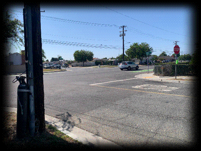
Crosswalk-free intersection of Kiowa Road and Edwards Street
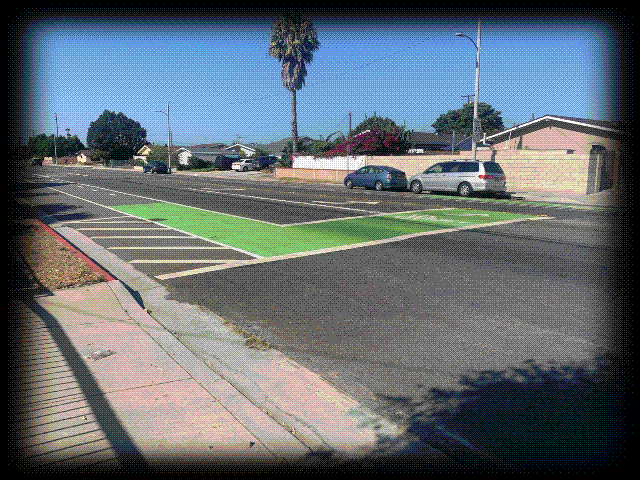
Bike box at the intersection of Trask and Edwards
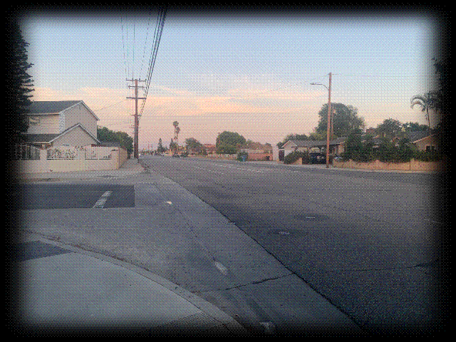
Hazard Avenue at Monroe Street, resembling Trask Avenue before redevelopment
|
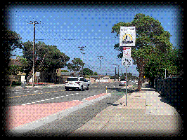
Section of Hazard Avenue in Santa Ana, with class I bikeways
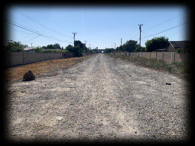
Property of former Naval Base railway, tracks were ripped out between 2012 and 2013
|


